
In our prior episode, I drove out of Arizona and through New Mexico where I still didn’t find my drivers’ license.
Texas!

Texas has the most farms and the highest acreage in the United States. The state is ranked #1 for revenue generated from total livestock and livestock products and #2 for total agricultural revenue. Beef cattle represent the largest single segment of Texas agriculture bringing $7.4 billion or 56.7% of the state’s annual agricultural cash receipts. Texas leads the nation in the production of cattle, horses, sheep, goats, wool, mohair, hay and cotton. Cotton earns $1.9 billion and dairy products make “only” $947 million.
Ever since the discovery of oil at Spindletop, Texas has grown to be the sixth largest oil producer in the world. The state has known petroleum deposits of about 5 billion barrels, which makes up about one-fourth of the known U.S. reserves. The state’s refineries can process 4.6 million barrels of oil a day. Texas also leads in natural gas production, producing one-fourth of the nation’s supply. Petroleum companies based in include Anadarko Petroleum Corporation, Conoco-Phillips, Exxon-Mobil, Halliburton, Marathon Oil, Tesoro, Valero, and Western Refining.
Despite the extraordinary mileage many Texans drive, they consume, on average, only the fifth most energy (of all types) in the nation per capita and as a whole, following behind Wyoming, Alaska, Louisiana, North Dakota, and Iowa.
I chatted with a gentleman in Amarillo who had driven across the state. He had a trailer-load furniture coming from his home in Houston to his “summer house” near Amarillo.
“I’ve already driven halfway to California,” he said. That was a Texas exaggeration but only by about 100 miles. Since I opted against El Paso and San Antonio for this trip, I’ll drive only 700 miles across Texas instead of 1,000.
My first view of the Lone Star State was a cotton field with oil derricks and there were almost uncountable horsehead pumps/nodding donkeys filling the fields the rest of the way in. The drive to Midland was mostly pretty desolate so I was surprised to see an orchard as I left one small town.
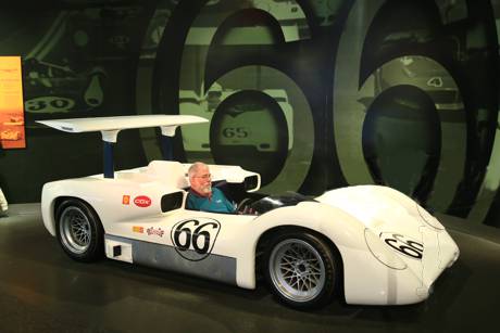
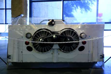
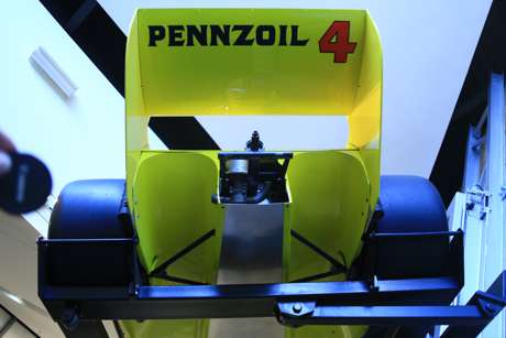
I made it to Midland in time to spend a couple of hours at the Permian Basin Petroleum Museum. Natch, I started at the Chaparral wing where I “test drove” the 2E and had my picture taken and drooled over all the other cars. Every one except the model I sat in is in running shape and kept that way purposefully.

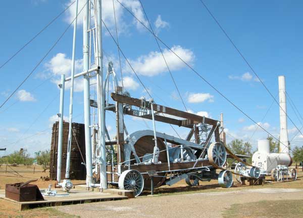
 After reading Zuckerman’s The Frackers: The Outrageous Inside Story of the New Billionaire Wildcatters, the museum’s “this is how it works” exhibits showed me the actual iron used from the earliest oil fields on. Many of the exhibits were created to teach kids how great oil and oil exploration is. Mythcrackers is one, with an introductory film that dispelling common petroleum myths in a Family Feud-style game show because “it’s what you think you know that just ain’t so.” They have a large display of paintings by artist Tom Lovell.
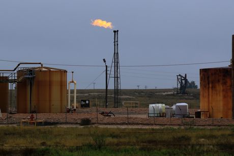 The industry museum shares the energy story and its impact on our daily lives with a journey through millions of years of history starting with the vast sea that covered the Permian Basin 230 million years ago.
Lightning chased me from the outdoor drilling and pump exhibits, though.
 I had reserved a room in America’s Best Value Inn because when I called ahead to make sure I could check in with my passport, the desk clerk reminded me to book online because it was cheaper. I was quite pleased to have the real frig which froze my ices solid in the room. I left just three in the coolers overnight to keep them reasonable, so I had only a little ice to get. On the other hand, I could.not.make.the.shower.work. The tub had no obvious diverter on the spout and no valve. I went to the front desk.
“This would have been a better night if you had a shower that worked or even a plug for the tub.”
“Oh, I’m sorry. You just have to pull on the thingie,” the desk clerk said.
Uh huh.
We eventually figured out that she meant to pull down on the aerator on the spigot. Like that’s intuitive.
It was going to rain so I had a waffle and headed for Shreveport.
Crossing the rest of Texas was a mostly boring, wet, ride. The rain started in earnest shortly after I left Midland, hammering down so hard some of the time that I used the fastest wiper speed and slowest truck speed, and continued until I was 50 miles from Louisiana. Traffic flowed at about 50 mph several times.
The highest speed limit I saw was just 75 and I don’t think anyone drove by at faster than 80 or 85. The rain meant I didn’t see all that much and wasn’t particularly enticed by any side trips. The rain also meant the NASCAR Cup race in Fort Worth turned into a night race, finally getting underway after a rain delay of nearly six hours Sunday. Reed Sorenson drove the #55 Trump-Pence Toyota which may have clinched the election although he finished the race in 35th.
Speaking of speed, Dale Earnhardt Jr. is still driving fast, even though he has been sidelined from NASCAR because of a concussion. Junior was pulled over for speeding while driving to Texas Motor Speedway on Sunday morning. His fiancee who was in the car with him tweeted a picture of a police officer writing out a warning for NASCAR’s most popular driver. According to her tweet, Junior didn’t get ticketed. She didn’t say how fast he was going.
 I passed the huge Sweetwater wind farm in Nolan County but just one turbine out of 346 was turning. Sweetwater was built in five phases with GE 1.5 megawatt S turbines, SLE turbines, and XLE turbines plus Mitsubishi 1.0 megawatt turbines and Siemens 2.3 megawatt turbines.
I also passed an LA Fitness right next to a Golden Buffet.
Gas was consistently above $2/gallon across the state and seemed to average between $2.09 and $2.19. I filled the tank with Sunoco in Midland for $1.999.
Next stop the J Bennett Johnston Waterway, Dave Robicheaux’s house on the Teche, and a po’ boy.
or Where I Think Government Should Spend Our Money
Let’s get something straight.
Climate Change is real.
Political Science is fake.
“Aides to the US president-elect, Donald Trump, … unveiled plans to remove the budget for climate change science currently used by NASA and other US federal agencies for projects such as examining Arctic changes, and to spend it instead on space exploration,” the Guardian reported.
“Shoot the messenger?” one correspondent asked. “Trump is cutting NASA’s arctic research because the agency brings inconvenient news.”
It’s interesting news and I’m halfway to liking it.
I like funding more deep space exploration. That and the development of colonization technologies is where NASA should spend its money now. Let the Commercial Spaceflight Federation members do the near Earth orbit stuff. And, it sends a message to the scientific community that we won’t fund all the “me too” studies any more. That’s all to the good. Still, I don’t like losing the NASA satellites monitoring temperature, ice, clouds, and other meteorological phenomena because the data itself is crucial.
“Mr Trump’s decisions will be based upon solid science, not politicized science.” Trump adviser Bob Walker said.
Yay!
Salon and other drum beaters call it “Politicizing climate change.”
Boo, hiss!
“Federal government scientists have been unnerved by Trump’s dismissal of climate science and are concerned that their work will be sidelined,” the Guardian reported.
Granted (heh), scientists who live from federal grant to federal grant like to know where their next meal will come from, but they make one important point.
 Anyone who has read history knows that the climate has changed many times in the last 4.543 billion years. Anyone who has read history knows that the climate changed a lot more before our first human ancestor developed speech and the ability to clear cut forests, a couple of million years ago. And, unfortunately, anyone who has read history knows that our climactic data from that time is woefully incomplete. We simply don’t have good, complete, contemporaneous data for planetary conditions two hundred years ago, let alone two million or two billion years ago.
Last week, we learned that “evidence suggests the Earth underwent an ice age so cold that ice sheets not only capped the polar latitudes, but may have extended all the way to sea level near the equator” around 700 million years ago but that during the Paleocene-Eocene Thermal Maximum “the poles were free of ice caps, and palm trees and crocodiles lived above the Arctic Circle.”
We don’t have enough actual data from any of those times even to build trustworthy quantitative climate models.
That’s an inconvenient truth for the alarmists who have the hubris to sell you that the rising sea will cut off the land bridge across the modern day Bering Strait (but that their settled science will cure it if we humans just stop breathing, farting, heating, and start paying higher taxes).
Loss of contemporaneous data for planetary conditions today is also an inconvenient truth for the real scientists who know that having that data is the only way our human descendants two millennia from now will know what we experience today.
We need good data about today now and we will need that good data about today 200 years from now, too.
Where should our governments spend our money? Beyond the alphabetically obvious answer of public arts, public education, public infrastructure, and public security and social protection, man has some imperatives that are best handled together. Exploration tops the list.
Basic science and basic data gathering is one such area and is an arena that jumpstarts exploration as well as commercial applications. We don’t need a new detailed map of the human brain because brain mapping is already commercially viable and well funded by private business. We do need to cure cancer. The biomedical industrial complex treats profits from its high-budget care but has no financial incentive to find a cure. We don’t need to study the effects of cocaine on Japanese quail because that’s better done by the cartels. We do need to explore beyond the solar system and we do need to explore this little blue marble we live on.
Every program government funds can profit from the “commercialization” filter.
NASA has publicly archived all of its data received from spacecraft projects — that’s over 4TB of new earth science data every day. The available data includes the CEOS International Directory Network, Earth Plus, Earth Observing System Data and Information System (EOSDIS), Gateway to Astronaut Photography, Global Change Master Directory, Global Imagery Browse Service (GIBS), Goddard Institute for Space Studies Earth/Climate Change Data, Goddard Earth Sciences Data and Information Services Center, LandSat 7 Datasets, NASA Earth Observatory, NASA Earth Observations, NASA’s HEASARC Web-based Tools, Ocean Color, Physical Oceanography DAAC, USGS/NASA Landsat Data on New Earth Explorer, Visible Earth, and more.
Global meteorological data. NASA may not be the best agency to interpret the findings but it is still the best agency to ferret it out for us. Pretty soon, we should examine that data for commercialization but, for today, it fits the basic data gathering filter and we need NASA to continue to record and store it.
We need that data so a future generation of researchers and scientists, unencumbered by politics and newspaper punditry, can build climate models that actually work.
Only when the tide goes out do you discover who’s been swimming naked.
–Warren Buffett
“Miami is going to flood tonight,” my alarmist friend Annabelle Proctor said. “It’s proof of Global Warming!” Ashley’s mother is a retired state employee and adjunct instructor with an undergraduate degree in dance from Bennington College and a graduate degree in Social Justice from Planet Marlboro, Vermont’s two most liberal and free-thinking schools.
And her consternation is partly accurate. The high tides this week are higher than I’ve ever seen ever before. Ever in my lifetime! That means in forever!
Tides are interesting. A spring tide is a common historical term that has nothing to do with the Vernal season. “The term derives from the concept of the tide ‘springing forth.’ Spring tides occur twice each lunar month all year long without regard to the season. Neap tides, which also occur twice a month, happen when the sun and moon are at right angles to each other.”
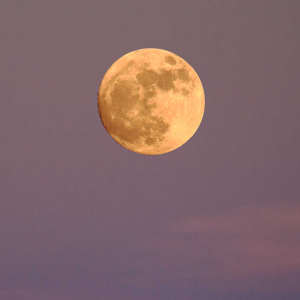 A spring tide conjoined with a Supermoon is worth writing home about. When a full moon is the closest it ever gets to Earth — at perigee — it seems bigger and brighter than usual. We’re seeing the biggest and brightest full moon since 1948.
Yeppers, must be Global Warming.
Lake Champlain water levels approached but didn’t quite hit a “record all time low.” The last time the water level was this low was over a century ago. That follows on the heels of a 100-year high set when Lake Champlain crested at 103.2′ in May, 2011, shattering the previous record high level in May of 1869
Contemporaneous quotes: “The lake is lower than I’ve ever seen ever before. Ever in my lifetime!” “The lake is higher than I’ve ever seen ever before. Ever in my lifetime! That means in forever!” Well, of course it is. Not many of us have been around for a century or more.
Yeppers, must be that Global Warming.
Yet another slow moving storm system is bringing rain, wind, and accumulating mountain snow to most of the Pacific Northwet and the northern Rockies for the first part of the week. And that eastern Cold Front that had mostly moved into the Atlantic has backed up a bit so it’s now curving from Lake Okeechobee up to a Low right over the Outer Banks. Lot of rain over eastern North Carolina right now. They need it.
And NOAA predicts minor coastal flooding of low-lying areas here in South Puffin.
* Coastal flooding…elevated saltwater levels tonight will result in nuisance tidal flooding of low-lying areas throughout the Florida Keys.
* Timing…saltwater levels will peak near the time of the higher high tide early tonight…and again at the next higher high tide mainly between 7 p.m. and midnight. Saltwater levels will likely remain elevated Monday through at least Thursday.
* Impacts…minor tidal flooding of low elevation streets and lots is likely. Some storm drains will overflow…and some docks and seawalls will be overtopped.
It was a cool 76°F with plenty of black bottomed clouds here in South Puffin this morning but the clouds have already burned off so it is mostly sunny now. Our sea walls are about five feet above sea level so I doubt they will be overtopped. Tomorrow’s rain may exacerbate it, so I figure the Inch Beach lawn will be awash again. It drains back very quickly and the grass is very salt tolerant.
The tide was very high when I shot the moon last night and it got my feet wet when I walked along the beach.
Yeppers, must be that oh-so-political Global Warming. Or maybe we should take a longer view than your lifetime or mine.
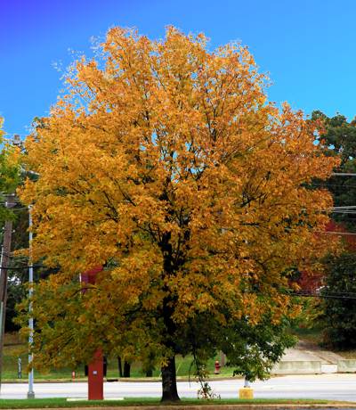
Best looking tree in Oklahoma:
In our prior episode, I had stayed in Weatherford, OK, and was off to Dead Women Crossing. There wasn’t a lot to see at the Crossing but I found some ghosts anyway.
I didn’t travel far that day. Weatherford, Oklahoma, to Amarillo, Texas, is under 200 miles and just about three hours driving time but I managed to take all day doing it. I went through Dead Women Crossing twice and in the meantime found sweet potatoes and cotton and more than enough red clay. My nice white truck is red.
Schoolteacher Katie De Witt James filed for divorce in 1905, then left by train from Custer City with her 14-month-old daughter Lulu Belle. The rest is an eerie, haunted tale of an angry husband, a reputed prostitute, a detective, and a headless corpse. A century has bleached Katie’s bones but her name is still attached to the last bridge she crossed.
Farther north along the N2440 Road, I picked a boll of cotton and discovered that harvesting sweet potatoes is still back-breaking work, despite our increased reliance on farm machines. I will never again complain about paying 29 cents/pound for sweets.
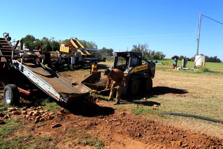
I’ve been following the Mother Road and stopped at the Farm & Ranch Museum in the National Route 66 Museum Complex in Elk City. I noticed that the lady on the cash register gave me the geezer discount.
“Nope,” she said. “I gave you the AAA discount.” Quick, she was. I wonder how she knew?
I also talked to a visiting nurse from Michigan who saw my Vermont plates. We were the only people there in shorts. She’s on her way to Phoenix for the winter. I wondered how it had gotten so cold!
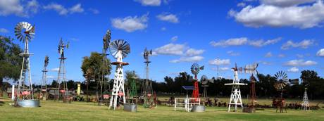
I saw more windmills in the distance and went looking for them. The towers are along the historical route of the Beale Wagon Road. In 1857, President Buchanan appointed Lt Edward Fitzgerald Beale to survey and build a more than 1,000 mile wagon road from Fort Defiance, New Mexico to the Colorado River, between Arizona and California. From then until 1860 Beale, a crew of 100 men, and 22 camels built the first federal highway in the southwest. Beale’s road roughly followed Lieutenant Amiel Whipple’s trail west across Arizona through the Flagstaff area and then a little north through Peach Springs and Truxton Wash, which was named for Beale’s son, before making its way through the Kingman area and on to the Colorado River.
The 123 Red Hills Wind Farm near Elk City has 82 turbines spread across 5,000 acres on land dominated by cattle grazing. The steers were unmooooooved by the windmills.
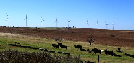
While I was photographing the turbines, an old farmer about my age stopped his pickup to ask “Did you know the tips reach 100 mph?” I said I did and we talked a bit.
That speed is in just 10 mph winds. The wind speed pushes the blades at 10-20 rpm. With average wind speeds of 13-15 mph, the tips travel at 120 mph but at maximum wind speeds, the blade tips can spin up to 180 mph.
“I live close by,” he told me, “about eight miles up the road.
“You know, you and I would have done right good to own the land under these.”
Ayup.
Political N00z
JOAN JETT 4 PREZ
painted on a barn.
Welcome to Texas.
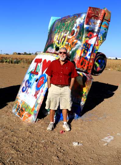
Cadillac Ranch is a public art installation in Amarillo. Chip Lord, Hudson Marquez, and Doug Michels of the Ant Farm created it about 40 years ago when they half-buried ten 1949 to 1963 Cadillac automobiles nose-first in the ground, all at the same angle of the Great Pyramid of Giza. The project’s patron, Stanley Marsh 3, also did the Floating Mesa, Amarillo Ramp, and the Dynamite Museum collection of fake traffic signs throughout the city. Writing graffiti on or the cars is now encouraged, and they are extraordinarily decorated. I may have been the only visitor without a spray can that day.
I landed in a $10 motel that should cost $20 and did cost $30 in Amarillo. On the plus side, its two-door refrigerator had a separate freezer so I could refreeze some of my ices. Maybe I should have just left them outside; I had the heat on for the first time since Vermont.
I went out to buy a cake for dessert and got thoroughly lost trying to find my way back to the motel. “Lila Too,” my Garmin GPS, doesn’t recognize the address they give and I hadn’t (then) figured out how to get it to store “right here” as a saved address.
Palo Duro and New Mexico next. If Lila Too can find ’em.