Road Trip XVI-7

I am still more or less following the Mother Road, Route 66.

In our prior episode, I had stayed in Amarillo, Texas, and was off to Palo Duro State Park and then on to New Mexico.
Off to Palo Duro--It's a Long Way to Tipperary

Palo Duro Canyon is part of the Caprock Escarpment located in the Texas Panhandle near Amarillo. It is the second-largest canyon in the United States.

No, I don’t understand why Texas calls it a “panhandle.” Granted, it is a narrow section but it sticks up from the broader area of the state. Oklahoma has a definite panhandle. Florida comes close with a very deep pan. Texas and Alaska, not so much.

Saturday was Palo Duro Canyon State Park’s annual History Day with lotsa lotsa stuff I’d like to see: living history reenactors, live firing of a real artillery piece and historic small arms, Kwahadi Indian Dancers, the Frontier Regiment of the High Plains, the TPWD Buffalo Soldiers, the 1st Texas Light Artillery, an atlatl throwing contest, cowboy poetry, a guided nature walk on the Pioneer Nature Trail, a tour of the CCC built cabins, and so on. I was there the day before.
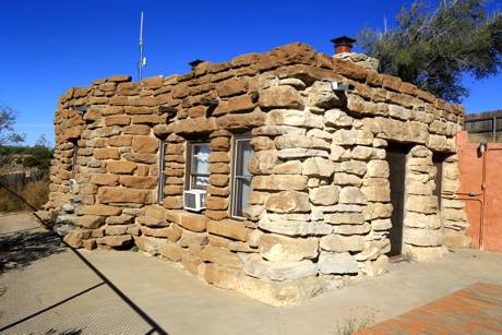
Civilian Conservation Corps Cabin at Palo Duro

It was great. I walked about six miles up and down hills, over rocks, and past rattlesnakes. The volunteer I spoke to also pointed me to the wildlife viewing stand where I’d be likely to see a “herd of turkeys.”
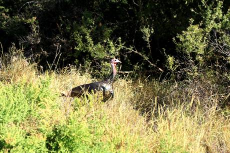
Turkey Buzzards at Palo Duro

This “Grand Canyon of Texas,” the second-largest canyon in the U.S., got its nickname for its size and for its multicolored layers of rock and steep mesa walls. It is about 70 miles long and some 6 miles wide on average but it narrows to nothing and widens to 20 miles in places. It’s up to 1,000 feet deep. The Spanish “Palo Duro” means “hard stick.”
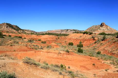
The Grand Canyon of Texas--the Hard Stick

The first European explorers to discover the canyon were members of the Coronado expedition, who visited the canyon in 1541. Apache Indians lived in Palo Duro when the first Spanish explorers arrived in 1541. Comanches and Kiowa tribes pushed the Apache west and traded with the Comancheros in nearby New Mexico. U.S. Army Captain Randolph Marcy mapped the canyon in 1852 and the army later forced the Indians to reservations in Oklahoma.

The canyon is filled with tent rocks, fairy chimney, or earth pyramids, better known as “hoodoos.” These tall spires of rock protrudes from arid drainage basins like the Palo Duro. The best known of the hoodoos is the Capitol.
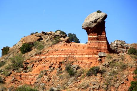
Palo Duro Capitol

The trails are also popular with mountain bikers.
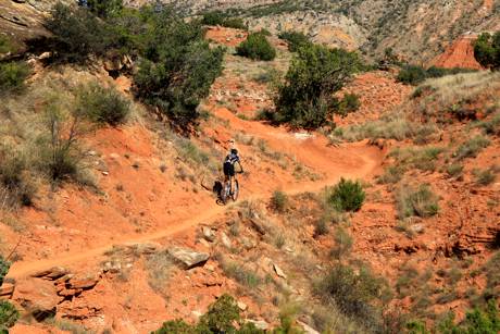
Palo Duro Biker

I met one experienced hiker who had often spent a week at a time heading back into the untraveled, unmarked sections of the canyon. “That’s where the animals are,” he told me. “I’ve seen bear and bobcat, plenty of deer, and of course, lizards and snakes back there where few humans travel.”

The area is riddled with caves. This cave is a natural sluiceway, open at the top to funnel the rainwater through. “I’ve been here when it rains,” the hiker said. “The water comes through like a tsunami.”
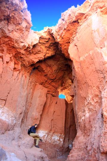
Palo Duro Cave

And I couldn’t go through a canyon without looking for water. This small riverbed still had some, despite the dry weather.
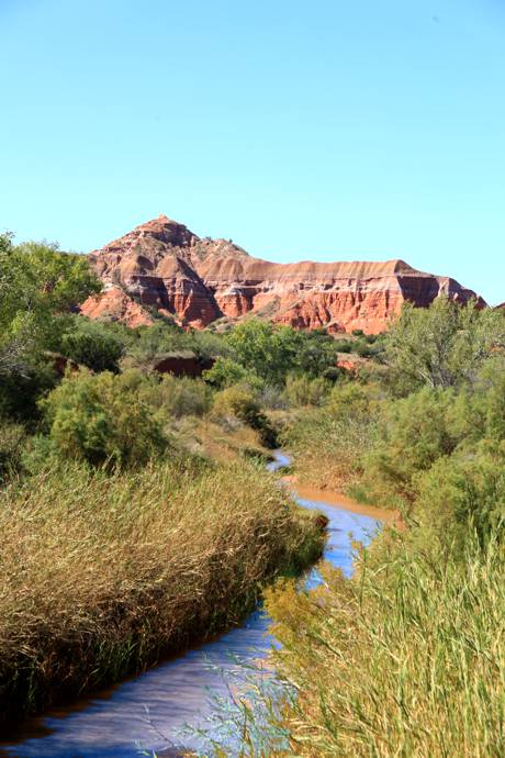
Palo Duro Water Crossing #1

Finally, the famed Palo Duro Lighthouse.
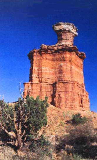
Palo Duro Lighthouse


Onward.

I think pretty much everyone knows by now that I mostly stay in the Motel 4-1/2 when I can’t couch surf. I generally find these motels by stopping at state welcome centers and grabbing the coupon books. I hadn’t done well on the coupon book so I went online to see what I could find [Sort: Price, low-to-high].

I met some other turkeys at Choice Hotels customer service.

See, I booked and pre-paid a hotel room through the Choice Hotels web portal. Unfortunately, they made the reservation for Friday, Nov 18, 2016, and I didn’t catch it; the hotel had never heard of me when I got to Albuquerque.

The front desk clerk was wonderfully sympathetic but didn’t have a mechanism to fix it since “you didn’t book through our own website.”

Huh? Choice Hotels is a holding company that owns Comfort Inn, Comfort Suites, Quality Inn, Sleep Inn, Clarion, Cambria Hotel & Suites, Mainstay Suites, Suburban Extended Stay, Econo Lodge, Rodeway Inn, and Ascend Hotel Collection. They have over half a million rooms in 6,379 properties worldwide.

I kinda figured that the Choice portal was the Rodeway portal. Of course, I thought I was booking into a Comfort Inn

Nupe on both counts.

She gave me three different Choice numbers from her directory to call. One was out of service. One connected to a veteranary clinic in Spokane. One was finally right. The foreign call center gentleman who answered wouldn’t fix the reservation dates; he just wanted to book me a new room for that night so I could pay them again. And to put me on hold three times to take breaks.

I escalated.

And waited.

And waited.

The Choice hold system repeats the same eight bars of two melodies over and over. And over.

I waited.

The supervisor, also overseas, was very polite but said he didn’t understand my problem. I mansplained the issue. He put me on hold and went on vacation. An hour later, after an hour of that intolerable hold music, they hung up. Just flat out disconnected the call.

The local crew took pity at least on my stick-to-it-iveness and figured out a way to put me in a room. It was late and I was tired and had missed supper but I slept in a $34 bed.

Two weeks ago, it was a Comfort Inn.

After a short night’s rest, I was up and off without my drivers’ license to the northwestern corner of New Mexico but that story is for our next installment.

 

Road Trip XVI-6

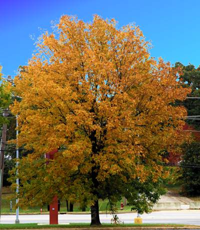
Best looking tree in Oklahoma:

OK-Best Looking Tree in Oklahoma

In our prior episode, I had stayed in Weatherford, OK, and was off to Dead Women Crossing. There wasn’t a lot to see at the Crossing but I found some ghosts anyway.

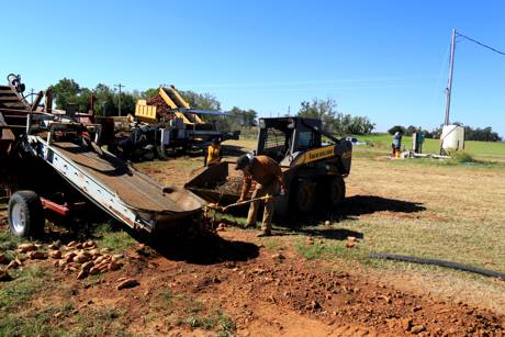
I didn’t travel far that day. Weatherford, Oklahoma, to Amarillo, Texas, is under 200 miles and just about three hours driving time but I managed to take all day doing it. I went through Dead Women Crossing twice and in the meantime found sweet potatoes and cotton and more than enough red clay. My nice white truck is red.

Schoolteacher Katie De Witt James filed for divorce in 1905, then left by train from Custer City with her 14-month-old daughter Lulu Belle. The rest is an eerie, haunted tale of an angry husband, a reputed prostitute, a detective, and a headless corpse. A century has bleached Katie’s bones but her name is still attached to the last bridge she crossed.

Farther north along the N2440 Road, I picked a boll of cotton and discovered that harvesting sweet potatoes is still back-breaking work, despite our increased reliance on farm machines. I will never again complain about paying 29 cents/pound for sweets.

Oklahoma Sweet Potato Harvest

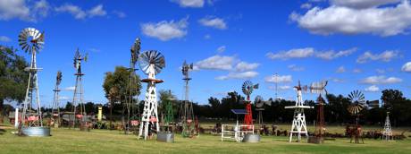
This may turn out to be the story of wind: thousands of windmills inhabit the prairie. Factory-made windmills have been used for pumping water on farms since the 1850s. Last year, wind power generated over 18 percent of the electricity produced in-state. At the end the year, Oklahoma’s installed wind capacity was 5,184 megawatts.

I’ve been following the Mother Road and stopped at the Farm & Ranch Museum in the National Route 66 Museum Complex in Elk City. I noticed that the lady on the cash register gave me the geezer discount.

“Nope,” she said. “I gave you the AAA discount.” Quick, she was. I wonder how she knew?

Farm and Ranch Windmills

A couple was there from somewhere else. The museum has a Ford 9N on the floor and I said I had one. He has an 8N.

I also talked to a visiting nurse from Michigan who saw my Vermont plates. We were the only people there in shorts. She’s on her way to Phoenix for the winter. I wondered how it had gotten so cold!

I saw more windmills in the distance and went looking for them. The towers are along the historical route of the Beale Wagon Road. In 1857, President Buchanan appointed Lt Edward Fitzgerald Beale to survey and build a more than 1,000 mile wagon road from Fort Defiance, New Mexico to the Colorado River, between Arizona and California. From then until 1860 Beale, a crew of 100 men, and 22 camels built the first federal highway in the southwest. Beale’s road roughly followed Lieutenant Amiel Whipple’s trail west across Arizona through the Flagstaff area and then a little north through Peach Springs and Truxton Wash, which was named for Beale’s son, before making its way through the Kingman area and on to the Colorado River.

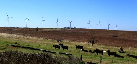
The 123 Red Hills Wind Farm near Elk City has 82 turbines spread across 5,000 acres on land dominated by cattle grazing. The steers were unmooooooved by the windmills.

Steers and Mills
 

While I was photographing the turbines, an old farmer about my age stopped his pickup to ask “Did you know the tips reach 100 mph?” I said I did and we talked a bit.

That speed is in just 10 mph winds. The wind speed pushes the blades at 10-20 rpm. With average wind speeds of 13-15 mph, the tips travel at 120 mph but at maximum wind speeds, the blade tips can spin up to 180 mph.

“I live close by,” he told me, “about eight miles up the road.

“You know, you and I would have done right good to own the land under these.”

Ayup.

Political N00z
JOAN JETT 4 PREZ
painted on a barn.

Welcome to Texas.

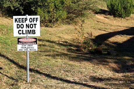
Welcome to Texas. Stay Away from Rocks and Tall Weeds

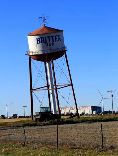
The Leaning Tower of Britten got my attention, as it was supposed to. The lean is intentional. Deliberate. Good, old-fashioned, American marketing got me to stop in the parking lot of Ralph Britten’s truck stop and restaurant in Groom, Texas. Two legs of that water tower dangle in mid-air.

The Leaning Tower of Britten

I also visited the world famous Cadillac Ranch which is not the world famous Mustang Ranch.

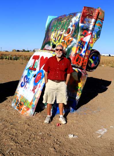
Cadillac Ranch is a public art installation in Amarillo. Chip Lord, Hudson Marquez, and Doug Michels of the Ant Farm created it about 40 years ago when they half-buried ten 1949 to 1963 Cadillac automobiles nose-first in the ground, all at the same angle of the Great Pyramid of Giza. The project’s patron, Stanley Marsh 3, also did the Floating Mesa, Amarillo Ramp, and the Dynamite Museum collection of fake traffic signs throughout the city. Writing graffiti on or the cars is now encouraged, and they are extraordinarily decorated. I may have been the only visitor without a spray can that day.

And to Think, Post Calls My Truck a 'Cowboy Cadillac'

The Mustang Ranch has other attractions.

I landed in a $10 motel that should cost $20 and did cost $30 in Amarillo. On the plus side, its two-door refrigerator had a separate freezer so I could refreeze some of my ices. Maybe I should have just left them outside; I had the heat on for the first time since Vermont.

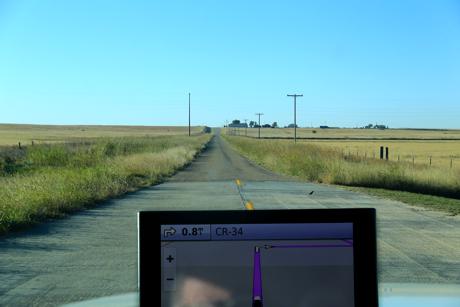
I went out to buy a cake for dessert and got thoroughly lost trying to find my way back to the motel. “Lila Too,” my Garmin GPS, doesn’t recognize the address they give and I hadn’t (then) figured out how to get it to store “right here” as a saved address.

Palo Duro and New Mexico next. If Lila Too can find ’em.